PUBLICATIONS
Samir F. Jreij, Whitney J. Trainor-Guitton, Michael Morphew, Ivan Lim Chen Ning. (2020) “The Value of Information from Horizontal Distributed Acoustic Sensing Compared to Multicomponent Geophones via Machine Learning.” Journal of Energy Resources Technology. JERT-20-1140
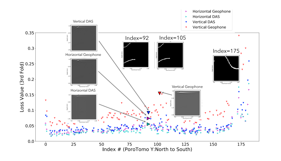
- This paper focuses on comparing distributed acoustic sensing (DAS) recorders to traditional geophones in determining fault location.
- My contribution to this research involves the convolutional neural network used to determine classification statistics for each data type. I suggested semantic segmentation as a method of classification and designed the neural network.
- Our work’s methodology forms a workflow for determining reliability statistics of highly sampled spatial data and serves as a tool for determining the best type and configuration of receivers to image a particular feature in the subsurface. This can aid geophysicists working in survey design and acquisition.

Comparison of U-net training using 3-fold validation. This provides a relative comparison between input data to determine which data result in the lowest validation loss.

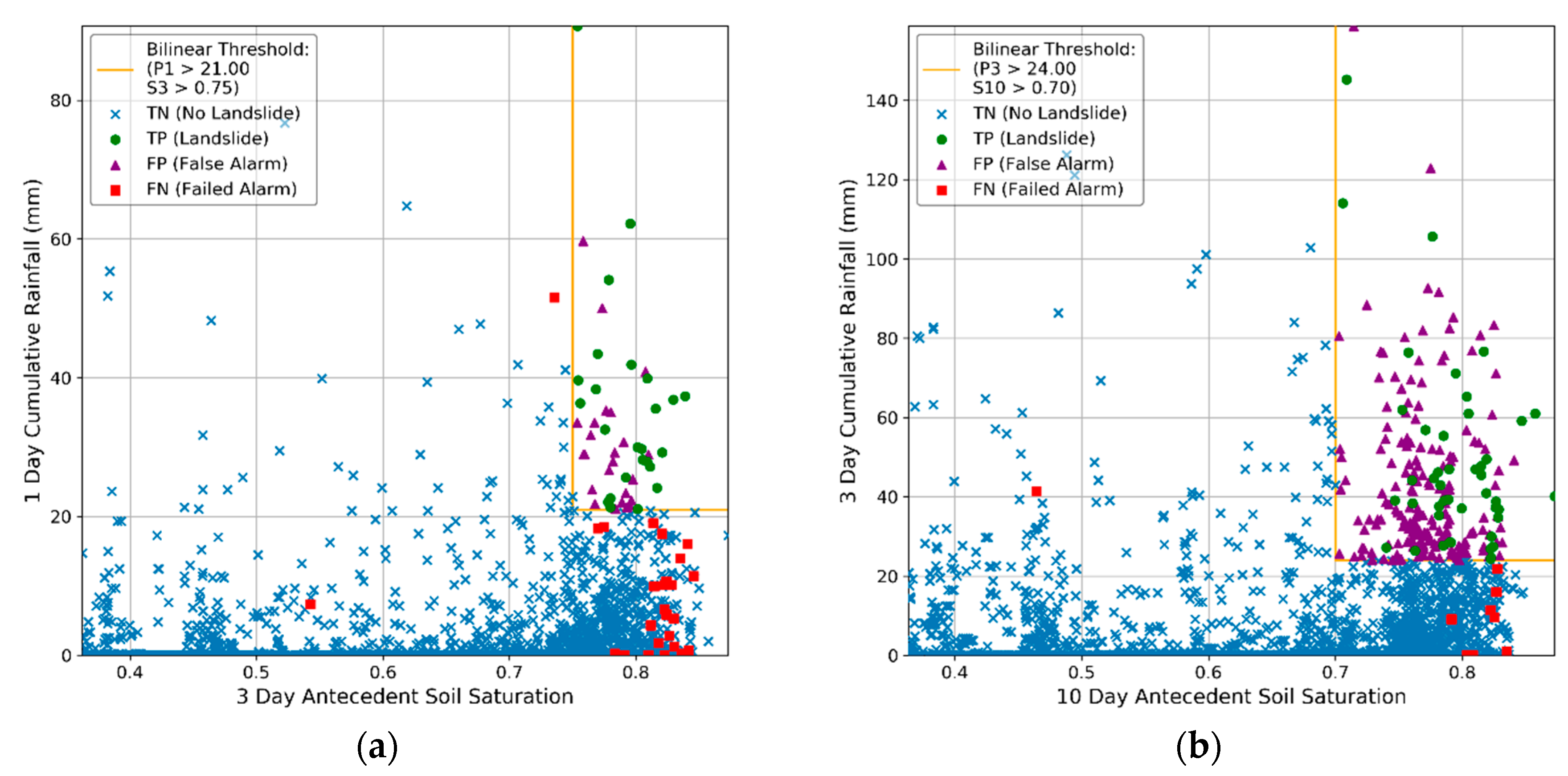
Two thresholds my code produced for the city of Portland, showing competing thresholds optimized with: (a) threat score; (b) optimal point statistic. Predicted landslide(s) are TP; false alarms are FP; no landslides are TN; missed landslide(s) are FN.
Benjamin B. Mirus, Michael D. Morphew, Joel B. Smith. (2018) “Developing Hydro-Meteorological Thresholds for Shallow Landslide Initiation and Early Warning.” MDPI Water. 2073-4441
- This paper focuses on developing the best threshold for detecting shallow landslides in the northwest United States.
- I designed and implemented the program that determines the best possible threshold given an input set of hydro-meteorological data, a landslide database, and the choice metric of success. This program is still in use by the USGS, and my co-authors are working on a public release for the code.
- The thresholds determined by this research and ongoing research will save costs and lives due to landslides. A tangible example of this is the railway traveling along Puget Sound in Washington, which can shut down if the threshold is exceeded, preventing trains from striking landslide debris.
